CAR, CAMERA, INSTRUCTION, ROUTE
The Topographic Photograph applies a standardized method to an unstable environment—an informational process shaped by movement, instruction, and inevitable failure. A car-mounted camera follows set instructions along a designated route, recording the port with the structured gaze of an infrastructural survey. But logistics is never without friction. Road closures, faulty GPS coordinates, and unexpected detours interfere, forcing adaptation and improvisation.
The system does not fail, but neither does it fully succeed. Instructions are followed, but rarely fulfilled—chance, misalignment, and human adjustments shape the final photographs. The landscape that emerges is not fixed, but processual, unstable, and shaped by the act of photographing it.
-> Click to see all 15 Route maps and instructions
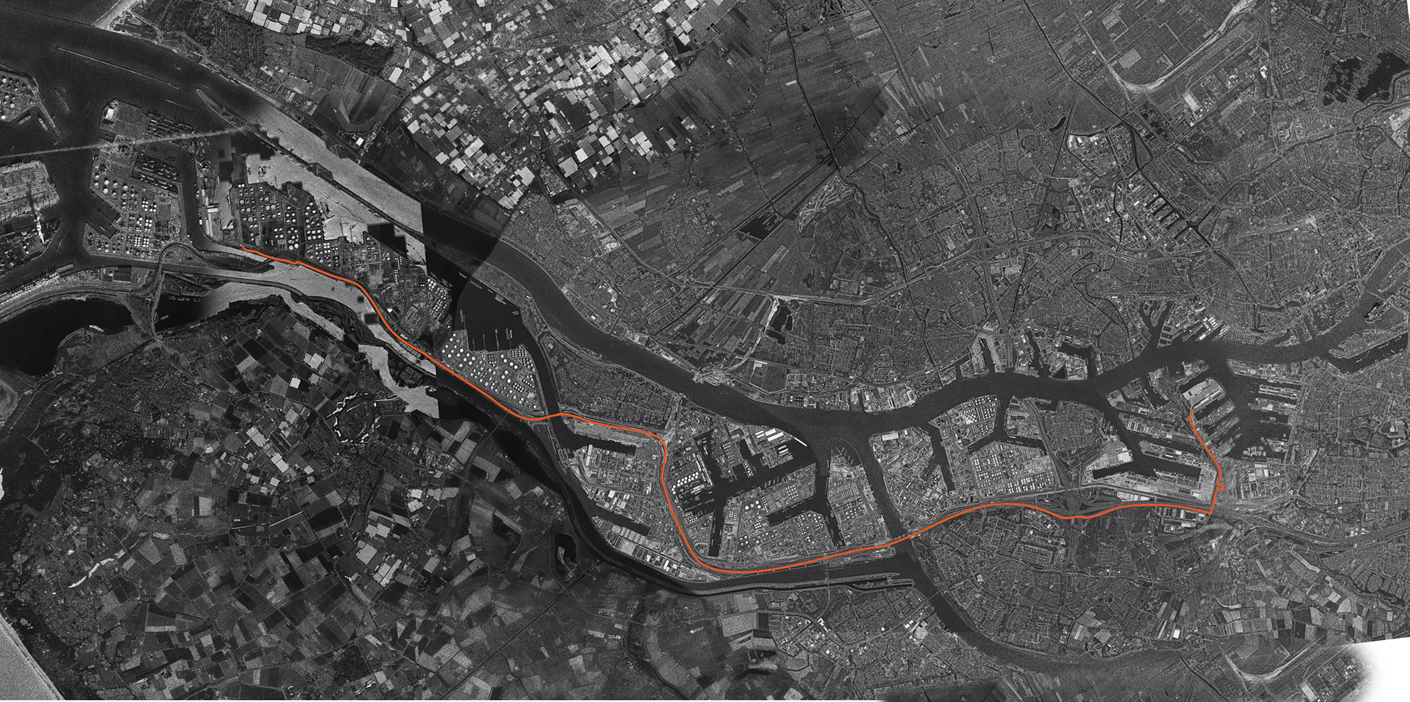
The Topographic Photograph applies a standardized
method to an unstable environment—an informational process shaped by movement,
instruction, and inevitable failure. A car-mounted camera follows set
instructions along a designated route, recording the port with the structured
gaze of an infrastructural survey. But logistics is never without friction.
Road closures, faulty GPS coordinates, and unexpected detours interfere,
forcing adaptation and improvisation.
CAR, CAMERA, INSTRUCTION, ROUTE
The system does not fail, but neither does it fully succeed. Instructions are followed, but rarely fulfilled—chance, misalignment, and human adjustments shape the final photographs. The landscape that emerges is not fixed, but processual, unstable, and shaped by the act of photographing it.
-> Click to see all 15 Route maps and instructions
Depart the P&O ferry terminal and end at the Port of Rotterdam’s Douane headquarters.
Task: Take one photo every few seconds. Try not to get stopped.
Distance: 31 kilometers